









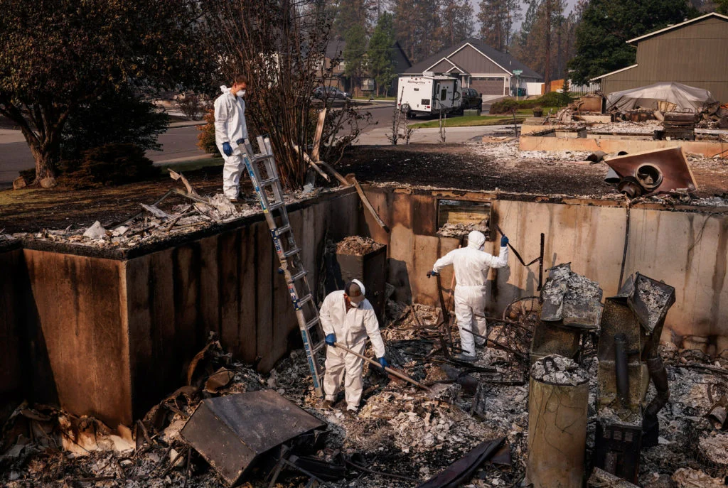
The year 2026 has etched itself into the record books as one of the most destructive in modern American history regarding wildfire activity. From the scorched landscapes of Washington State to the fire-ravaged forests of Europe, the climate crisis is manifesting in increasingly volatile, fast-moving, and unpredictable infernos. As the frequency and intensity of these events reach a fever pitch, the traditional methods of fire detection—relying on human observers and 911 reports—are proving insufficient.
In response, a technological revolution is unfolding. A new generation of artificial intelligence, integrated into high-resolution camera networks and satellite constellations, is changing the landscape of fire suppression. By identifying heat signatures and smoke plumes before they are even visible to the human eye, these systems are providing firefighters with their most powerful advantage yet: time.
The Escalating Crisis: A Decade of Record-Breaking Heat
The scale of the current wildfire threat cannot be overstated. Statistics from the first half of 2026 indicate that the United States has seen a higher volume of ignitions and a greater total acreage burned than in any year over the past decade. This is not a statistical anomaly, but a direct consequence of a changing climate.
The Prolonged Fire Season
Data from Climate Central underscores a sobering reality: the "fire season" is no longer a seasonal event, but an increasingly year-round phenomenon. In parts of the American West, the duration of fire-conducive weather has expanded by approximately two months compared to the 1970s. Hotter, drier, and windier conditions have turned forests into tinderboxes, creating a "perfect storm" that allows small ignitions to balloon into catastrophic mega-fires in a matter of hours.
The Chronology of Innovation: From Orbit to Ground
The shift toward AI-driven detection has moved from experimental pilot programs to mission-critical infrastructure in a remarkably short window.
July 2026: The Satellite Surge
The technological offensive began in earnest in July 2026, when a rocket launched from the California coast deployed a new class of space-borne sensors. Known as "FireSat," these satellites are the vanguard of a planned 50-unit constellation designed for global coverage.
The primary objective of the FireSat program is ambitious: to detect any wildfire—regardless of size, including blazes as small as a beach bonfire—within 20 minutes of ignition. By monitoring the Earth’s surface continuously, these satellites bypass the limitations of ground-based visibility, providing an aerial view that ignores the obstacles of dense terrain or remote wilderness.
The Ground Game: Pano AI and ALERTCalifornia
While satellites provide the "big picture," terrestrial networks are providing the granular data necessary for immediate dispatch.
San Francisco-based startup Pano AI has emerged as a leader in this space, deploying over 1,400 high-resolution cameras across 17 states. These cameras, often mounted on cell towers in elevated locations, rotate continuously. They are equipped with sophisticated algorithms that perform real-time image analysis. During the day, the AI scans for the specific spectral signature of smoke; at night, it switches to thermal sensors to detect anomalous heat signatures against the cool backdrop of the forest floor.
Simultaneously, California’s state-run program, ALERTCalifornia, has integrated its own network of 1,200 AI-enabled cameras. This initiative has become a benchmark for how state agencies can synthesize large-scale data to streamline the "detection-to-suppression" pipeline.
Technical Mechanics: How the "Digital Eye" Sees
The power of these systems lies in their ability to filter noise. A traditional camera feed requires a human operator to constantly monitor screens—an exhausting and error-prone task. AI, by contrast, acts as a tireless sentry.
- Continuous Scanning: The cameras rotate in 360-degree sweeps, creating a constant stream of visual data.
- The Algorithm: The AI is trained on millions of images of fire and smoke, allowing it to distinguish between low-hanging clouds, morning mist, dust, and actual combustion.
- Human-in-the-Loop: Once the AI flags a potential ignition, it does not act autonomously. It alerts a human analyst who verifies the imagery. If a fire is confirmed, the system immediately transmits the precise GPS coordinates to fire dispatch centers.
This rapid-fire verification process allows agencies to deploy resources to a specific location before a single 911 call has been placed by a civilian.
Official Perspectives: Shifting the Paradigm
For fire professionals on the front lines, this technology has moved from a "nice-to-have" luxury to a "must-have" necessity.
The "Have-to-Have" Tool
Assistant Chief Brendan Finnegan of West Metro Fire Rescue in Colorado describes the implementation of AI cameras as a fundamental shift in his agency’s operational capacity. "Having those eyes that can alert us well in advance of a 911 call is a massive value," Finnegan notes. For crews tasked with protecting the wildland-urban interface, the difference between a five-minute alert and a twenty-minute delay is often the difference between a containment effort and an evacuation order.
The Goal of Total Suppression
Cal Fire Chief Phillip SeLegue offers a metrics-based defense of the technology. Cal Fire’s primary operational goal is to suppress 95 percent of all wildfires at 10 acres or less. In a climate-stressed environment, this goal is increasingly difficult to reach. However, Chief SeLegue reports that 50 percent of the fires currently being suppressed were detected by the AI network before any human witness alerted authorities.
"The fires that the system has helped us dispatch resources to are the fires that you don’t read about in the papers," SeLegue explains. "The ones you don’t see are the ones we’ve successfully contained at a manageable size."
Implications: The Future of Fire Management
The adoption of AI in fire detection carries profound implications for policy, environment, and public safety.
Economic and Environmental Impact
The cost of fighting a mega-fire runs into the hundreds of millions of dollars, not including the long-term economic damage to property and the environmental loss of carbon-sequestering forests. By catching fires early, agencies are not only saving lives and property but also drastically reducing the carbon footprint of the fire itself.
Scaling the Solution
As the wildfire crisis intensifies, the scalability of these AI networks will be tested. There are several hurdles to overcome, including:
- Connectivity: Remote regions often lack the high-speed data infrastructure required to transmit real-time, high-definition video feeds.
- Integration: Different agencies—federal, state, and local—must create interoperable systems so that a fire detected by a satellite can be immediately handed off to the nearest ground crew.
- Privacy and Oversight: As camera networks expand, there is a growing need for clear guidelines on the use of these surveillance tools to ensure they remain focused strictly on environmental safety.
A New Era of Resilience
The "Tipping Point" we are currently witnessing—where the environment is changing faster than our traditional defenses can handle—requires a pivot toward proactive, data-driven strategies. While technology cannot reverse the warming climate or eliminate the underlying causes of drought and wind, it provides a crucial layer of resilience.
As we look toward the remainder of the decade, the integration of AI-enabled satellite constellations and camera networks will define the next chapter of forest management. By empowering firefighters with the ability to see the danger before it escalates, we are moving toward a future where "fire season" might once again be a manageable challenge rather than a source of recurring national tragedy. The machines are now the first line of defense, and for the communities living in the shadow of the forest, that represents a profound, life-saving shift.